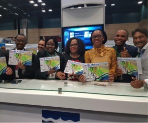
The Water Research Commission (WRC) today set the trend as world leaders with the launch of the world’s first ’mine water atlas’ in partnership with consulting firm Golder Associates. The event was also part of the World Water Day Celebrations that saw the global Launch of the UN World Water Development Report 2017: “Wastewater: The Untapped Resource” at the international conference centre, Durban, South Africa. The mine water atlas was officially launched by the honourable Minister of Water and Sanitation, Ms. Nomvula Mokonyane.
The South African Mine Water Atlas, provides a comprehensive reference on the vulnerability of water resources to mining activity in South Africa and will be launched at the United Nations World Water Day event on 23 March 2017, at the Durban ICC. The Atlas will highlight the critical interplay between mining and water resources and will be the most extensive set of documents of its kind. “We’re very excited about this project. It’s a world first. No country in the world has done this before,” said Water Research Commission research manager Dr Jo Burgess. The project, which was led by consulting firm Golder Associates, aimed to deliver the most comprehensive document of its kind in South Africa.
The Atlas will introduce mine water and its geological, hydrological and legal context, while examining the geographical foundations of water quantity, quality and distribution, as well as the challenges and opportunities facing South Africa as it strives to improve the quantity, quality, protection and use of its water resources. “Decision-makers will be able to look to the Atlas for background information and tools to assist in fulfilling commitments made in other recent events and declarations,” explained Burgess. “The Atlas uses various measures to illustrate South Africa’s hydrological characteristics by charting and mapping water resources on a provincial scale.” Further, each mining-affected province and the challenges, and opportunities it faces are addressed.
The Mine Water Atlas in application:
The multi-layered set of maps spans all mineral provinces in South Africa and particularly drills down into the areas where mining frequently takes place. The maps chart the water resources in the various provinces and in turn are overlaid with maps of mining and mineral-refining activities, in order to understand the locations at which surface and groundwater and mining collide. The Atlas is intended to help mining companies, investors, government departments and students get a better understanding of the impact of mining on water resources. While it is an extremely useful guide, the Atlas does not replace Environmental Impact Assessments (EIAs) or tell you where you can or can’t mine, but assists with the decision-making process around the likely impacts of mining activity in a given mineral region. The Atlas can be used to see what the potential liabilities may be and what the focus of mitigation measures may need to be to protect water resources in an area of operation; for example, water treatment plants may be needed to ensure water discharges from the mines are of good quality and won’t damage the environment or pose a risk to public health.
Mining often comes under the spotlight for water pollution problems. Uncontrolled discharge of acid, neutral, and saline mining-impacted water can have a devastating effect on surface and ground water resources. Acidic water leaching out of mine dumps can flow into rivers or streams, stop plants from growing and kill the food chain from the bottom up. When left unchecked, the dirty water generated from mining activities finds its way into surface water features such as rivers and wetlands, negatively impacting both downstream users and the aquatic environment.
• The Atlas will help government departments to visualise and highlight areas that are very risky, and help define the key questions for impact assessment
• It will serve as an educational reference for legislators as well as universities.
• It is geared towards raising awareness among the public about the critical link between water and mining.
The Mine Water Atlas for South Africa’s primary benefit lies in the ability to assess cumulative impacts of mining in a catchment, through the understanding of the presence of upstream mines (both operational and derelict) and the sensitivity of the receiving water environment. This in turn will enable an improved understanding of an individual’s mine’s potential impact versus the cumulative impact.
The Water Research Commission is committed to leading research that will continue to produce ground breaking interventions such as the Mine Water Atlas and will continue to partner with industry to translate leading research into tangible implementations that ultimately inform legislation, drive innovation, educate the public and ultimately improve the quality and quantity of water resources.


